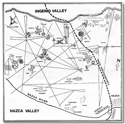
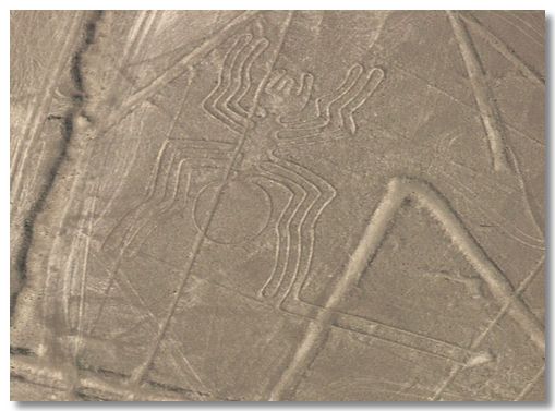
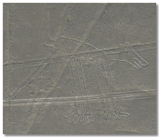
The Nazca Lines etched into the desert are spread over an area of some 50 miles across. This map shows the main geoglyphs. They are very confusing to make out as they appear to be randomly spread round the desert & hills. They are a mixture of abstract shapes, (such as trapezoids) and various fauna. The dotted line running North West is the main Pan American highway. I find it incredible that they built the highway without realising what they were destroying.
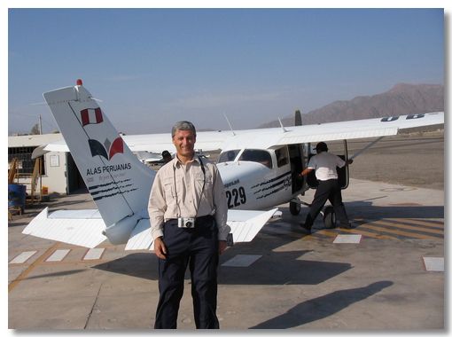
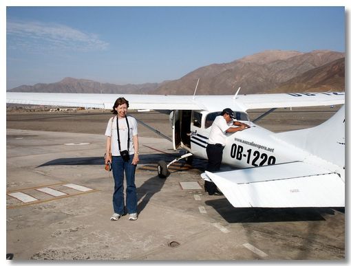
I don't have a head for heights. Nor was I impressed by an old plane with only four seats and ill-fitting doors. The pilot (was he warned about me?) had two emergency paper bags for my seat. Did I need them? See below!
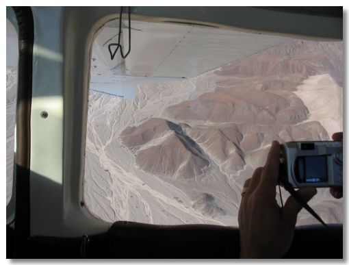
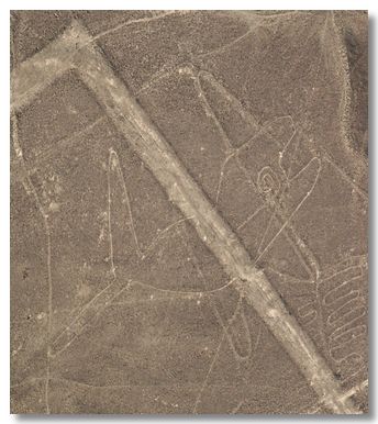
As we approached each geoglyph, the pilot would indicate which wing tip we were to concentrate on, then tilt the plane alarmingly (hence the paper bags), and count down, 3-2-1, when the image would then be seen under that wing-tip. In this example the Astronaut is on the hill under the right wing tip.
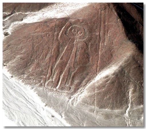
This is the photo Ann recorded me taking in the above photo. OK, its enlarged a bit, but you can see the image called the Astronaut quite clearly.
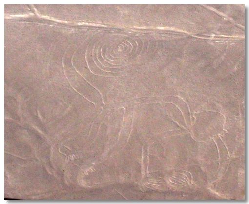
The Nazca Lines are in the desert strip between the Andes and the Pacific Ocean. There are no monkeys here. Why then was such an image created some 2,000 years ago?
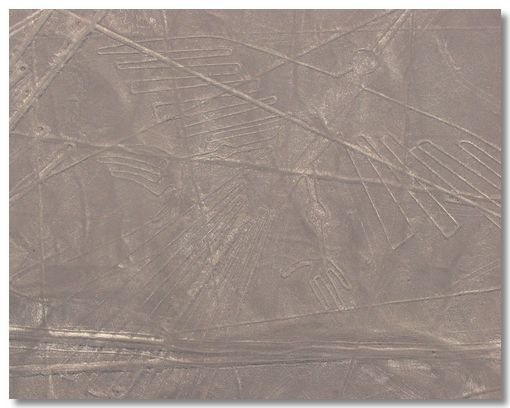
Some of the straight lines are other superimposed geoglyphs. Some are simply car tracks made before anyone realised what they were ruining.
Sometimes we just had to trust the pilot and take photos, hoping that once we enlarged them, we might then spot an image. There were so many lines criss-crossing each other, it was sometimes very difficult to spot the images.
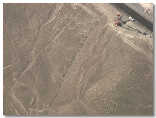
The white car and viewing tower give an idea of the scale of these two geoglyphs - the Hands are lower right and the Tree is upper left.
Flying over the Nazca Lines was an experience that I won't ever forget. Luckily the Kwells that Ann gave me before the flight allowed me to (just) avoid needing to use any of the two paper bags that were provided!
To those who ever read the book "Chariot of The Gods" by Erich Von Daniken, I can confirm that it is a load of old hogwash (IMHO!). In the book he claimed the lines were to guide Extra Terrestrials landing on Earth.
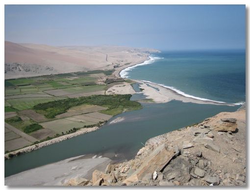
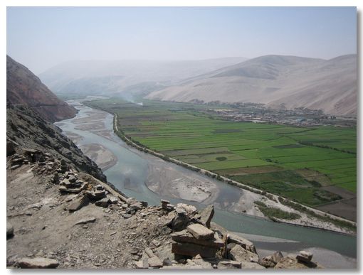
Most of the west coast of Peru, including Nazca, is desert. This is because the rain-bearing clouds coming in from the Pacific are drawn up by the high Andes, hence no rainfall here. In this region, there are about 50 rivers that flow from the Andes to the Pacific. Along the valleys and plains formed by the rivers, the land is cultivated, but immediately beyond them, it is back to desert.
These two photos taken at the same place show this.
The first, above, shows the view towards the Pacific Ocean, the second, below, is in the other direction, towards the Andes range.